“We promise to add rich detail to our maps so that anyone will be able to go online, click on the maps, and immediately learn where we are working and what we are doing.” (Jim Yong Kim, Annual Meetings 2013)
For the first time, the World Bank Group’s (WBG) full portfolio, including IFC and MIGA is on the map (maps.worldbank.org). This accomplishment marks the completion of the geo-mapping target President Kim announced at the 2013 Annual Meetings. It is the result of a long collaboration across the WBG team’s to overcome numerous hurdles and successfully built on the foundation put down by the Mapping for Results team.
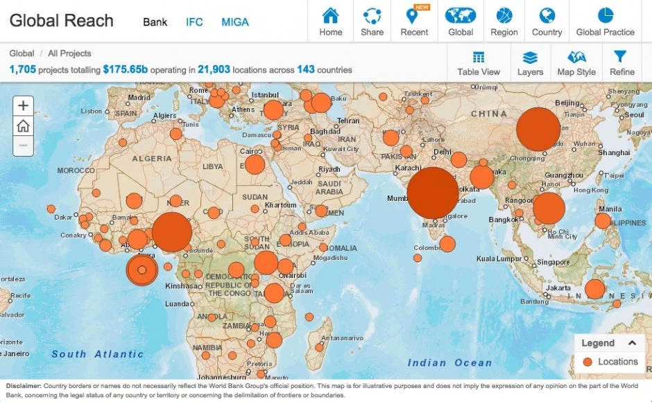
In times where cross cutting solutions and engagement of the private sector have become crucial to development, we need to show as comprehensive a picture of our operations as possible. We need to know where our money is going. We need to know whether our activities reinforce each other and we need to share such information with our partners and civil society. All of this is important context for anyone planning or evaluating an operation.
The World Bank Group not only made a commitment to open data, but using geocoding technologies to improve transparency, analysis and operations is fast becoming a standard tool around the world for development projects and public management. The African Development Bank recently launched its own project map and platforms like the Open Aid Partnership and AidData compile project level data on over several trillion dollars in development finance from a wide range of bilateral and multilateral agencies. The Bill and Melinda Gates foundation hosts the FSPmaps.org, which provides a far more detailed understanding of financial access in certain developing countries than existed ever before. Other national level public institutions are moving in this direction too; the Government of the Philippines integrated geo-tagging into their public procurement system, which makes it possible to locate delivered goods. The Mozambique Ministry of Mineral Resources uses these tools to improve transparency and promote investment in the mining sector, as have many other countries. Showing where the money goes is becoming the new normal.
So while this accomplishment is important and we want to draw your attention to it, we won’t stop here. Putting projects on a map is really just the beginning. Several challenges lay ahead, some projects by their sheer nature do not lend themselves to mapping in this manner. Making sure that this effort is sustainably linked to operations and country diagnostics is still work in progress. We need to address gaps in subnational poverty data, add further relevant layers and enhance functionality to make this a useful tool.
From there, we could go in many directions. At this point, we would like to hear from you! What are your priorities for development related data? What would you like to use this map for and what is missing?
Fill in this short survey or leave your comments below and help us take this forward!


Join the Conversation